San Diego County relies on a dense network of freeways and urban streets that move millions of people daily. High speeds, heavy traffic, complex interchanges, and varied terrain create documented crash hotspots along key routes like I-5, I-8, I-805, SR 52, and SR 163. This article identifies the most dangerous segments and explains underlying risk factors with practical safety takeaways.
Roads and Risk in San Diego County Overview
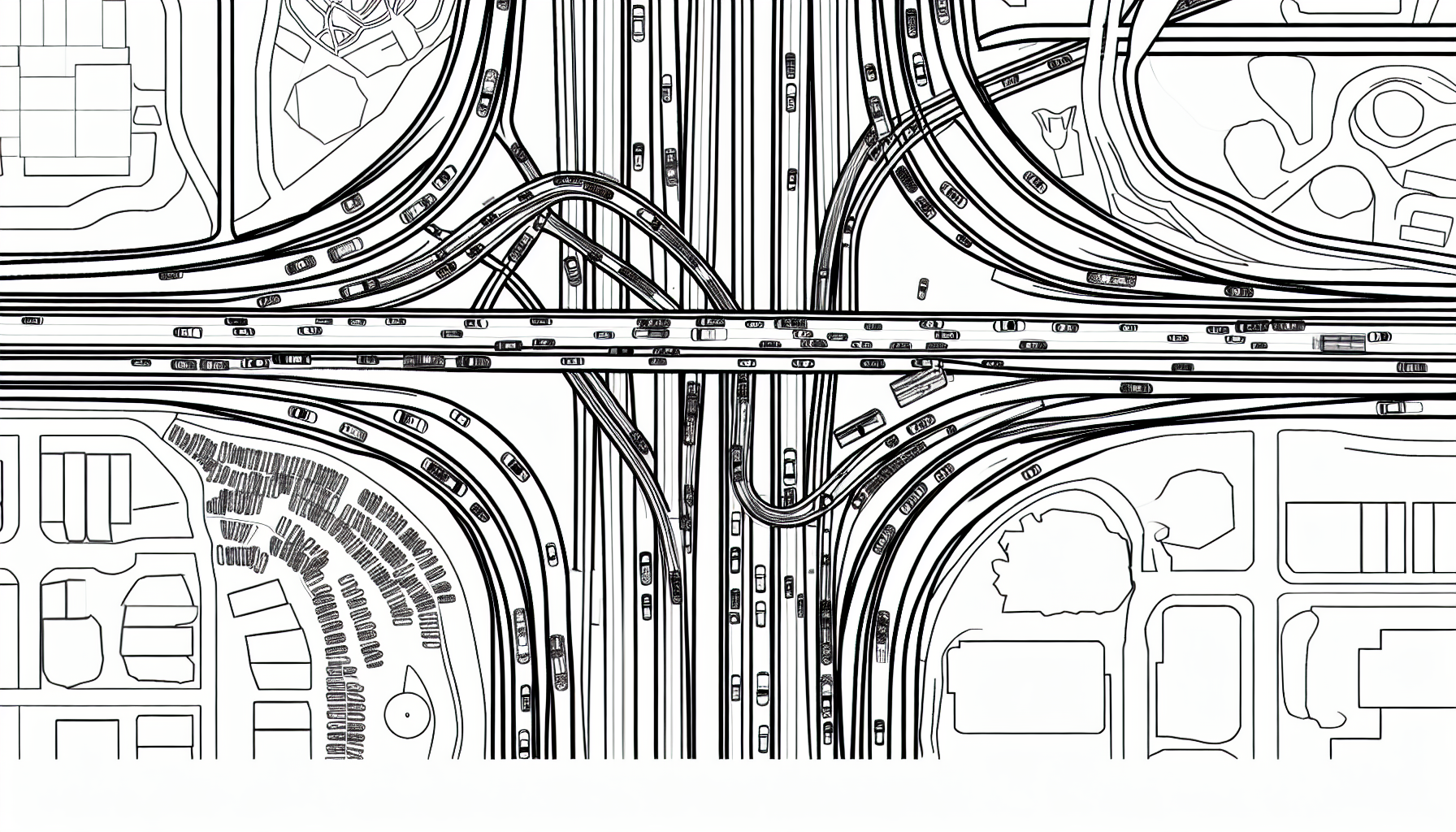
San Diego County’s transportation network is a complex labyrinth that connects diverse communities and regions, but certain corridors stand out for their heightened danger levels. Among the most concerning stretches of roadway is the I-5 corridor, a major artery that runs from the Mexican border, through urban San Diego, and northward toward Los Angeles. This corridor is notorious for being a crash hotspot, especially as it traverses areas with high population density, such as Downtown San Diego and National City.
The I-5 is pivotal for both local and interstate travel, which means it sees significant traffic volume, further exacerbating safety concerns. Daily commuters, tourists, and freight transport converge on this corridor, leading to increased congestion and, subsequently, a higher likelihood of collisions. The geography of the route also plays a role; with its adequate number of lanes and interchanges, drivers often feel compelled to accelerate, reaching high speeds in both urban and suburban zones. This combination of elements creates a perfect storm for accidents.
Several key factors contribute to elevated crash risks along the I-5 corridor:
- High Speeds: Areas with fewer traffic controls allow vehicles to reach and maintain higher speeds, increasing the severity of potential collisions.
- Dense Traffic: As one of the busiest highways in the region, heavy traffic can lead to stop-and-go conditions, creating opportunities for rear-end crashes.
- Merging Zones: Interchanges and connector ramps often require rapid lane changes, which can result in collisions, particularly during peak hours.
- Weather Conditions: San Diego’s climate is predominantly sunny, but occasional rain can lead to slippery road conditions, increasing the risk of accidents if drivers do not adjust their speed.
Specific areas within this corridor are recognized for their elevated risk levels due to these factors. For instance, the following interchanges and zones have been identified as notable hotspots:
- The I-5 and I-805 interchange
- The downtown segment of I-5 between the 8 Freeway and the Coronado Bridge
- National City areas near the mile-long stretch of I-5
- The stretch before and after the San Diego Bay Bridge
For drivers navigating the I-5 corridor, adopting a defensive driving approach is crucial. Key safety-focused strategies include maintaining a safe following distance, remaining attentive during merging opportunities, and adjusting speeds according to traffic conditions. Awareness of surroundings and adherence to traffic regulations can significantly mitigate risks associated with this pivotal yet perilous highway. As we delve deeper into the specific corridors and interchanges in subsequent chapters, understanding these foundational factors regarding the I-5 will aid in developing a comprehensive view of road safety in San Diego County.
I 5 Corridor Danger Points
The I-5 corridor serves as a major artery through San Diego County, stretching from the Mexican border in the south to its northern boundary near Camp Pendleton. This freeway is a vital link for both local traffic and commutes, as well as an essential route for freight and tourism. Segmenting into urban zones, particularly around downtown San Diego and National City, the I-5 presents numerous challenges that elevate its status as a crash hotspot.
Urban sections of the I-5 are characterized by high traffic volumes, frequent merges, and a fast pace of travel. Commuters, tourists, and commercial vehicles all utilize this corridor, intensifying the risk of accidents. Speed limits in these areas can reach 65 mph, which, combined with dense traffic, creates a precarious environment, especially during peak hours. The high speeds contribute to the severity of collisions, while merging lanes can lead to sudden stop-and-go traffic, which is a known contributor to rear-end collisions.
Environmental factors also play a significant role in the safety of the I-5 corridor. Coastal weather conditions can lead to fog and rain, reducing visibility and making road surfaces slippery. These factors can be particularly hazardous for lanes that are prone to pooling water, especially during and after heavy rains.
To further highlight risk areas along the corridor, it is important to identify specific interchanges and zones with elevated crash risks:
- Interchange at I-5 and I-805: This busy junction sees frequent lane changes and heavy traffic, increasing the likelihood of accidents.
- Pacific Highway Exit: Near the airport, heavy traffic merges with local streets, creating a chaotic driving environment.
- Downtown San Diego (Gaslamp District): Dense traffic and numerous pedestrians contribute to higher crash rates.
- National City Interchange: A congested area with multiple merging lanes that complicate navigation.
- La Jolla Shores Exit: Frequent tourist activity increases the risk of sudden stops or wrong turns.
For drivers navigating the I-5 corridor, the following safety-focused guidance can help mitigate risks:
- Maintain a safe following distance to accommodate for sudden stops.
- Avoid distractions such as mobile devices while driving.
- Be alert in high-traffic zones and stay mindful of merging vehicles.
- Reduce speed during inclement weather and increase following distances accordingly.
- Look out for pedestrians, particularly in urban areas near downtown San Diego.
By understanding the dangers present along the I-5 corridor and adopting these safety precautions, drivers can contribute to a safer driving experience for themselves and others on the road.
I 8 Mountain Crossing Hazards
The I-8 corridor presents unique challenges as it weaves through San Diego County, particularly as it crosses through mountainous terrain and descends into the valley regions. Starting in the coastal areas and advancing eastward, the route navigates Mission Valley before tackling steep grades within the Cleveland National Forest. Here, drivers encounter four prominent summits exceeding 4,000 feet – Carpenter Summit, Laguna Summit, Crestwood Summit, and Tecate Peak. These mountain crossings are notorious for various hazards that significantly elevate crash risks.
One of the primary risks is the steep grades encountered at various points along this segment of the I-8. As vehicles ascend and descend these slopes, the potential for loss of control can increase, particularly for larger trucks. The steep inclines demand a careful approach, and the lack of escape routes in certain areas further complicates matters. Additionally, changing weather conditions can impose sudden challenges; rainfall, fog, and occasional snowfall can limit visibility and lead to hazardous roadway conditions.
Specific passes like Carpenter and Laguna Summit are especially prone to issues with visibility during early morning or late evening hours, when the sun’s position can create blinding glare. Moreover, the tendency for rockslides and debris on the road, particularly after heavy rains or during seasonal changes, requires drivers to remain vigilant.
To navigate these mountain crossings safely, drivers are encouraged to consider the following strategies:
- Maintain a Lower Speed: Adjust your speed to account for steep grades and potential hazards on the road.
- Use Appropriate Gearing: For larger vehicles, downshifting can provide better control on steep declines.
- Stay Informed: Check weather reports before traveling, and be aware of alerts regarding road closures or hazardous conditions.
- Keep a Safe Following Distance: Ensure ample space between yourself and the vehicle ahead to allow for any sudden stops.
- Utilize Turnouts: If you need to slow down or take a break, be sure to use designated turnouts to avoid obstructing traffic.
Understanding and mitigating these risks is crucial for anyone traveling the I-8 through the mountainous regions of San Diego County. Drivers must remain vigilant and adaptable to the changing environment, ensuring a safer journey through this beautiful but perilous stretch.
I 805 Urban Congestion and Structural Challenges
I-805 is a vital corridor connecting the southern border to the Sorrento Valley, offering a comprehensive view of urban dynamics unique to San Diego County. This freeway serves as a crucial bypass for traffic heading north and south, yet it is marred by congestion and structural challenges that significantly contribute to crash risks.
As vehicles approach the Mission Valley Viaduct, one of the key bottlenecks on I-805, the complexity of interchanges increases dramatically. Here, the merges with I-5 and SR 163 represent some of the most problematic zones for motorists. These interchanges, often crowded with vehicles attempting to navigate multiple directions, have historically been points of collision, particularly during high-traffic hours. Recent data from the California Highway Patrol indicates that approximately 25% of accidents on I-805 occur near these interchanges, underscoring the urgent need for enhanced safety measures.
The freeway has undergone several widening projects in the past, which have not completely alleviated congestion. Each expansion seems to only provide temporary respite as population growth continues to swell the number of commuters. The original design did not fully account for the steep increase in volume alongside the city’s rapid urban development.
Additionally, the physical characteristics of I-805 contribute to its dangers. With limited space and tight merging lanes, drivers often face challenges while changing lanes or exiting, which leads to sudden stops and rear-end collisions. Data shows a marked increase in accidents during peak commute times, prompting the need for precautions during these hours.
To mitigate these risks effectively, the following measures are recommended:
- Enhance signage. Clear and visible road signs can greatly reduce confusion at complex interchanges.
- Implement dynamic traffic management systems. Real-time data showing traffic flow can help drivers make informed decisions.
- Increase law enforcement visibility. More frequent patrols during peak hours can deter reckless driving and speed violations.
- Encourage public transportation use. Expanding transit options may reduce the number of vehicles on the freeway, lessening congestion.
- Promote carpooling initiatives. Programs to incentivize carpooling can further decrease the overall vehicle count on I-805.
Investing in these strategies is crucial to improving safety and flow on I-805, thus safeguarding the lives of countless drivers navigating this essential thoroughfare.
SR 52 and SR 163 Bottlenecks and Hazards
State Route 52 (SR 52) and State Route 163 (SR 163) serve as crucial east–west thoroughfares in San Diego County, providing significant connectivity between suburban areas and key urban destinations. SR 52 stretches from La Jolla in the west to Santee in the east, traversing a stretch of diverse topography, including the Rose Canyon Fault region and the scenic Mission Trails Regional Park. This route facilitates connections with major freeways such as I-805 and I-15, often leading to heavy traffic and substantial crash risks at these critical interchanges due to high volume merging zones and navigational challenges.
Meanwhile, SR 163 runs from the northern suburbs to downtown San Diego, passing through the distinct Balboa Park area. Originally designated as US 395, SR 163 underwent evolution into an Interstate-standard freeway, featuring several sharp curves and parkway sections that can catch drivers off guard. Known for its aesthetic views of the park, this route also sees increased pedestrian and cyclist activity, particularly in and around Balboa Park, contributing to heightened safety concerns.
Bottlenecks are prevalent on both SR 52 and SR 163, particularly in heavily trafficked zones where exits converge. These roadways often experience slowdowns at crucial points, which are exacerbated during peak hours when commuters and recreational traffic coincide. The combination of high traffic volume and complex interchange configurations leads to an elevated risk of collisions in these areas.
- Risk factors: Poor visibility due to terrain features, high commuter volume, and merging maneuvers at interchange points.
- Interchanges: High-risk areas include the interchanges with I-805 and I-15 on SR 52 as well as the connections between SR 163 and I-5.
- Mitigation strategies: Increased signage, improved lane markings, and semi-annual reviews of accident data to monitor high-risk zones.
Historically, incidents along these routes highlight emerging patterns; for instance, the Balboa Park corridor has faced challenges with traffic mismanagement and increased vehicular congestion during major park events. As the city continues to grow, so does the necessity for a robust review of roadway designs and safety measures, ensuring that these vital highways can accommodate both their intended traffic loads and provide a safe journey for all users.
Urban Streets and Arterials in Coastal Cities
Urban streets and arterials in San Diego County’s coastal cities present a unique set of challenges, contributing significantly to the overall danger experienced by drivers, pedestrians, and cyclists alike. These narrow corridors often combine dense mixed traffic with complex signal systems, creating a perilous environment for all who navigate them. Notably, areas surrounding Balboa Park, particularly as they intersect with SR 163, exemplify the risks inherent in urban transportation.
The coastal regions, including neighborhoods like Hillcrest, Mission Hills, and Little Italy, frequently see a high volume of both vehicle and foot traffic. The presence of parked cars, combined with bike lanes, creates a constant flux of movement that can be daunting to navigate. Cyclists often contend with abrupt lane changes and the necessity of merging in and out of busy thoroughfares, leading to higher rates of accidents. Pedestrians, meanwhile, face the hazards of crossing sprawling intersections with multiple turning lanes and limited visibility due to larger vehicles obscuring sightlines.
Several specific corridors stand out as particularly hazardous. One example includes the approach to Balboa Park via SR 163, where the merging lanes are not only steep but also subject to heavy congestion during peak hours. The park’s attractions draw crowds, increasing both foot traffic and the potential for accidents as visitors scurry to enjoy the facilities amid the hustle of cars. Additionally, the mixed-use paths adjacent to the park lure cyclists who may not be adequately protected from vehicular traffic.
Urban errors can be further exacerbated by poorly synchronized traffic signals, which cause frustration and lead to risky driving behavior. Drivers often rush through, ignoring bicycle and pedestrian signals, leading to dangerous encounters at busy intersections.
To enhance safety across these vital urban thoroughfares, consider the following advice:
- For Drivers: Stay vigilant for cyclists and pedestrians, especially at intersections and during peak tourist seasons. Observe speed limits and be patient during congested times.
- For Cyclists: Use designated bike lanes where available and remain aware of your surroundings; never assume that motorists see you.
- For Pedestrians: Always use crosswalks and avoid jaywalking. Make eye contact with drivers before crossing and wear visible clothing at night.
leave with practical safety takeaways and heightened awareness today.